No Products in the Cart
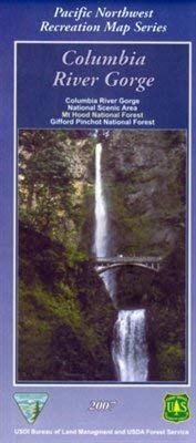
The Columbia River Gorge is a spectacular river canyon cutting the only sea-level route through the Cascade Mountain Range. It's 80 miles long and up to 4,000 feet deep with the north canyon walls in Washington State and the south canyon walls in Oregon State.
Through millenniums of geologic events, waterfalls have found their home in the Columbia River Gorge. A visit to the area is not complete without a visit to its breathtaking waterfalls. Multnomah Falls is the second highest year-round waterfall in the United States. Though Multnomah Falls is grand and popular, all of the falls in the Gorge are special and breathtaking. Recreation Hiking, mountain biking, windsurfing, camping, fishing, boating, wildlife watching, birding, wildflower viewing, photography, picnicking, and rock climbing—you can do all this and more in the Columbia River Gorge National Scenic Area.
 As Seen On TV