United Stated Department of the Interior
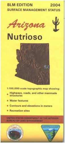
Nutrioso, Arizona 1:100,000 Scale Topo Map Surface Management BLM 60×30 Minute Quad
$ 15.95
$ 19.95
60'×30' topographic & surface land management map of the Nutrioso region of Arizona and New Mexico covering from 109 to 110 East Longitude and 33.5 to 34 North Latitude. It includes legends for recreational symbols, land status, special symbols, and topographic map symbols. It also features indexes to 1:24,000-scale topographic maps as well as recreation sites, trails, and areas. A township diagram and scale for kilometers and miles completes the map.
- Applies to: Arizona; New Mexico.
- BLM map shows roads, campgrounds, and topographic detail.
- Differentiates between public and private land, and also among the various agencies who manage the public lands.
- Map covers part of Apache-Sitgreaves National Forests and Fort Apache Indian Reservation.
- No BLM land shown.
- Enjoy the scenic areas within the Apache National Forest and portions of the Mogollon Rim; try camping, hiking, horseback riding, biking, and OHV riding.
- A section of the Eagle National Recreation Trail is shown on the map.
- Scenic driving on Hwy 191, the Coronado Trail Scenic Byway.
- AZ Hunting Units 1, 25, and 27.
- Scale 1:100,000.
- 2004.
- One-sided, self-cover, paper/non-laminated folded map.