Wide World Maps & MORE!
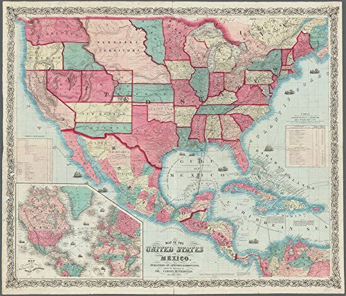
1859 Map of the United States and Mexico [Map] Carlos Butterfield
Originally published by Johnson & Browning under the direction of Col. Carlos Butterfield, this reproduction of the hand colored map features relief shown by hachures and spot heights; depths shown by soundings; and includes illustrations of ships, historical notes, "Table of Distances", inset "Map showing the routes of the ocean steamers", and "Table showing the route of the steamers of the United States and Mexican Mail Steam Ship Line and the various ports in the Gulf of Mexico at which they are to touch, as also the distances between the said ports".
Entered according to Act of Congress in December 1859 by Johnson & Browning to the Clerks Office of the District Court of the United States for the Southern District of New York, this one-sided 28.5"x24" non-laminated paper wall map has its prime meridians at Washington & Greenwich and covers W 125⁰--W 64⁰ & N 49⁰--N 5⁰ at a scale ca. 1:6,250,000.
43990


