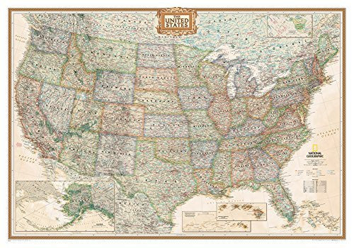
National Geographic Maps
United States Executive Political Map, Enlarged 69 x 48in & Ready-to-Hang
A current political map that features the United States in rich, earth-toned colors. Astounding detail and boardroom quality make this map excellent for reference in your home or office. This map is enlarged and laminated — featuring a high-shine surface and durable plastic covering.
Gloss Lamination features premium optically clear film which provides a high shine for dramatic color presentation.
Ready-to-Hang maps have rails at the top and the bottom to keep the map flat against the wall with two loops on the top rail for easy hanging. A package of wall hooks and nails completes the set.
National Geographic is a renowned authority in cartography. For 120 years the Society's maps have helped spread geographic knowledge around the globe. A vast database allows National Geographic to combine the latest data gained by space-age technology with innovative digital mapping techniques to create state-of-the-art political, physical, and thematic maps. The Society's meticulous research and attention to detail have established a standard of achievement that is unparalleled.
- 69" × 48"
- Scale: 1:2,815,000
- 44293GR