


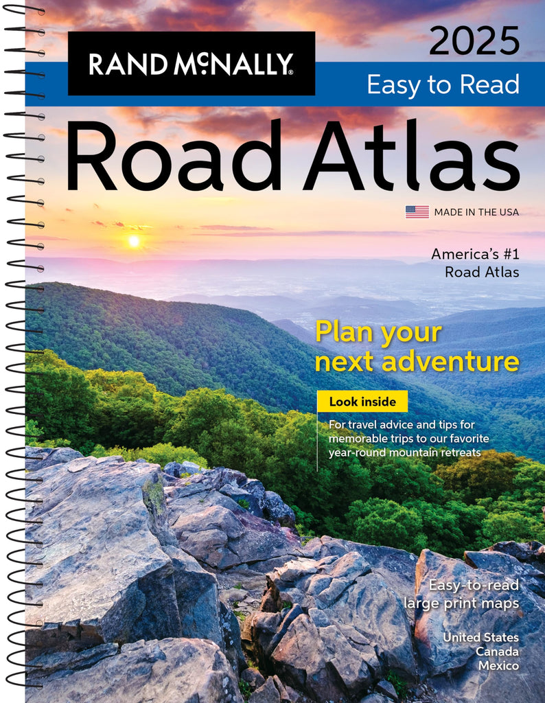


Rand McNally & Company
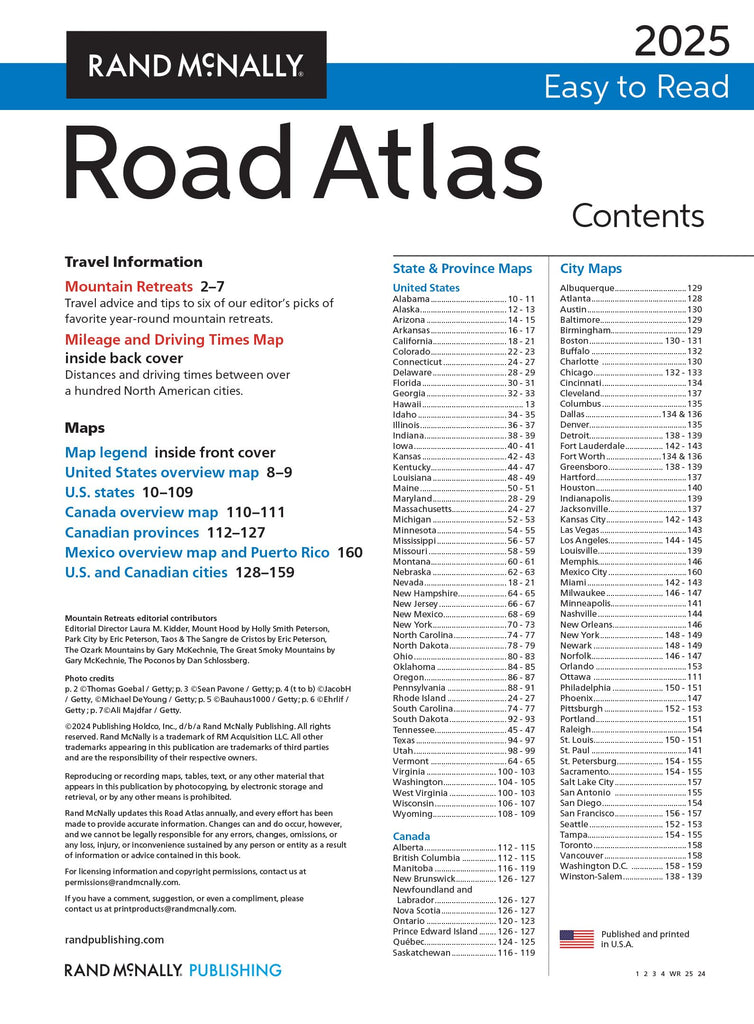
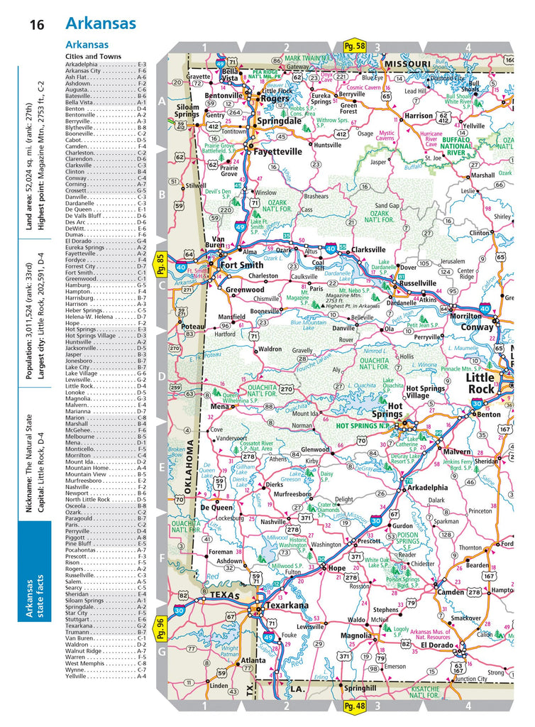
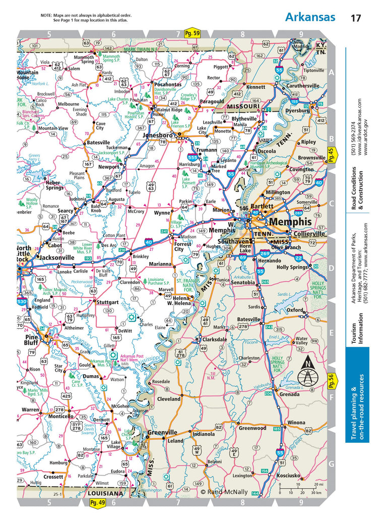
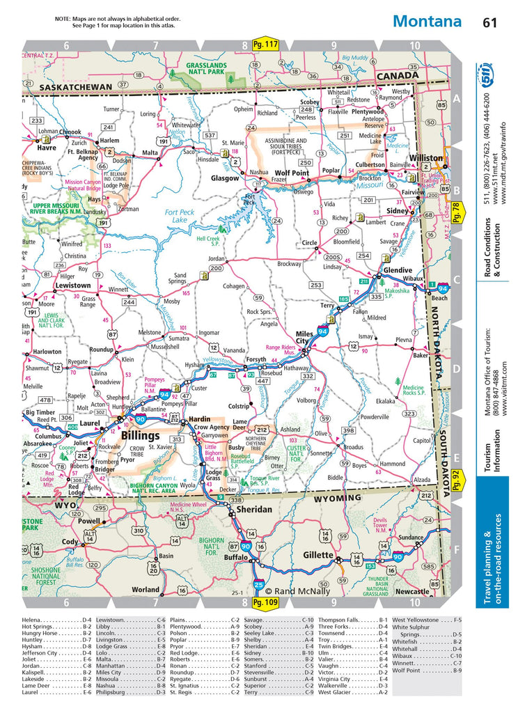
Road Atlas 2025: United States, Canada, Mexico Easy to Read Large Print Maps
$ 19.99
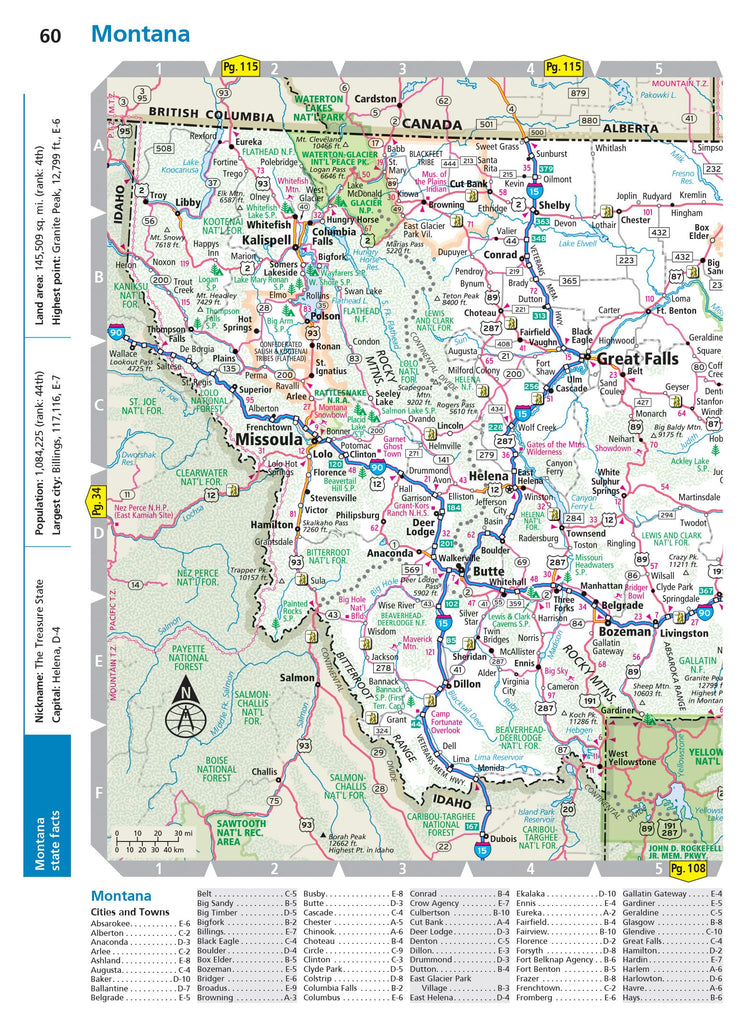
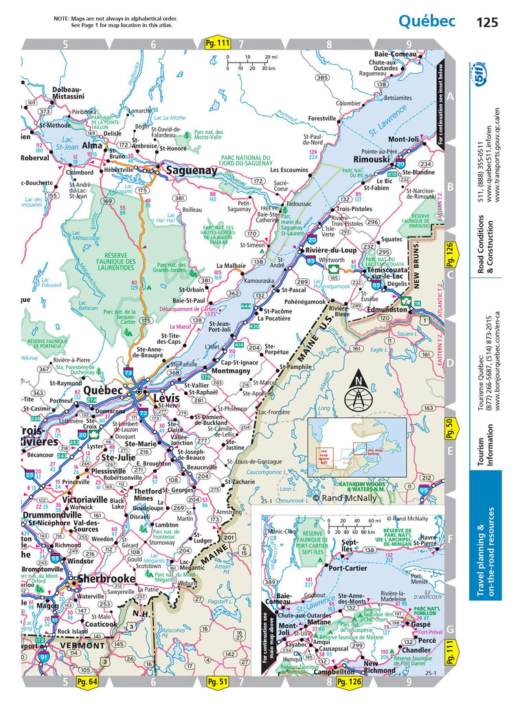
This updated 2025 midsize easy-to-read edition features large print maps of every U.S. state and Candian province, plus an overview map of Mexico, in a convenient travel size that fits in a glove box. Included are detailed inset maps of more than 50 North American cities, plus a Mileage and Driving Times Map showing distance and approximate driving times between hundreds of cities. Spiral binding allows the books to lay open easily.
Additional Features:
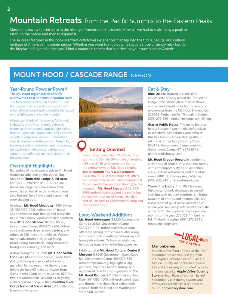
- Rand McNally presents our editor's favorite year-round mountain retreats, with travel advice and tips from places to stay, family activities, and where to eat.
- Tourism websites and phone numbers for every U.S. state and Canadian province on map pages.
- Road construction and conditions contact information for every U.S. state and Canadian province.
- City index conveniently located on map pages.
- Made in the USA.
- Product Details:
-
- Dimensions: 8" × 10.8125".
- Spiral bound.
- 75119